Introduction
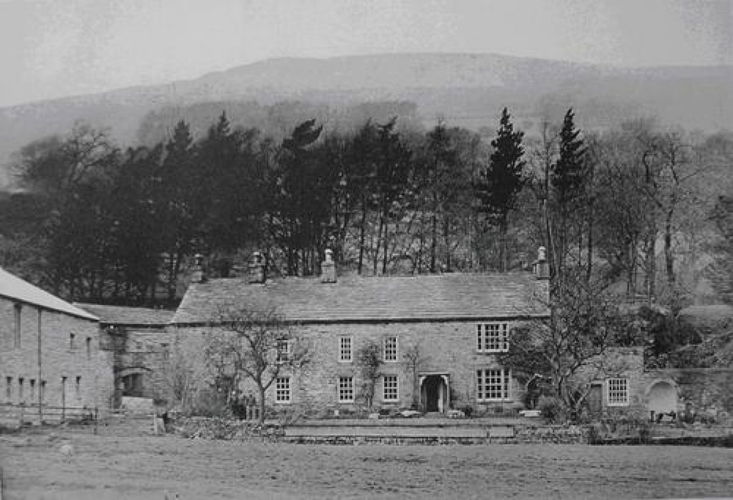
The garden, lying to the south-east of the house, is approached through an arch giving onto an open space. This adjoins an old farmhouse, which is now a barn. The stone-edged flower bed immediately in front of Carr End House is bordered by wide stone flagged path which extends north-eastwards passing an adjoining off shot building. A finely-cut stone wall, some 12 feet high, runs from the off shot building to the eastern end of the garden. A curved sheltered alcove is let into this wall. The garden itself is bordered to the south-east by a ha-ha type wall and railings with a stream at its foot.
Location, Area, Boundaries, Landform and Setting
Carr End House faces towards the south-east, below the road to Marsett, and just to the west of the southern end of Semerwater.
Principal Building
The north-west side of Carr End House faces a range of narrow single-storied buildings cut into the natural rock with two double-width bee boles and one double-height narrow rectangular recess let into them. The north-west face of the single storied offshoot to the main house also has two double width bee boles, side by side with a smaller recess to the west of them all about two and a half feet from the ground.
Gardens and Pleasure Grounds
The garden, lying to the south-east of the house, is approached through an arch giving onto an open space. This adjoins an old farmhouse, which is now a barn. The garden itself is entered through a doorway in the west wall at right angles to Carr End House with the inscription ‘I F 1667' on the lintel. The stone-edged flower bed immediately in front of Carr End House is bordered by wide stone flagged path which extends north-eastwards passing an adjoining off shot building.
A finely-cut stone wall (Burtersett stone), which is around 12 feet high, runs from the off shot building to the eastern end of the garden. A curved sheltered alcove is let into this wall. The wall returns at right angles to make the north-eastern boundary of the garden. A round-topped arch in this wall leads into an area marked as an orchard on the Ordnance Survey six inch map of 1845/5. The garden itself is bordered to the south-east by a ha-ha type wall and railings with a stream at its foot. This stream comes down from a small waterfall to the north of the house and is then channelled past its west side to the ha-ha.
To the north-east of Carr End a boathouse is marked on the edge of Semmerwater. Alexander Fothergill refers to his boat in his diaries, stating ‘One strange acquisition was a pair of trows, a double boat, in which he made excursions on Semerwater.'
- Visitor Access, Directions & Contacts
Directions
The house is to the west of the southern end of Semerwater, below the Marsett Road.
- History
The house, the property of the Fothergill family from at least 1667 until 1841, was probably a simple farm house in the 17th century. It was substantially enlarged in the 18th century when some of the rooms were panelled. This was probably the work of Alexander Fothergill (1709-1788) who, from 1751 until 1775, kept a journal of his work as ‘surveyor of the turnpikes' and his other business activities. Unfortunately only sections of this journal have survived (19-29 June 1751, 4 May 1754 to 24 February 1757 and 28 December 1773 to 11 January 1775). However, the alterations to the garden and the building of the alcove are recorded in the 1774 and 1775 surviving extracts.
- Features & Designations
Features
- Farmhouse (featured building)
- Latest Date:
- Path
- Description: The stone-edged flower bed immediately in front of Carr End House is bordered by wide stone flagged path which extends north-eastwards passing an adjoining off shot building.
- Wall
- Description: A finely-cut stone wall (Burtersett stone), which is around 12 feet high, runs from the off shot building to the eastern end of the garden.
- Ha-ha
- Description: The garden itself is bordered to the south-east by a ha-ha type wall and railings with a stream at its foot.
- Stream
- Bee Bole
- Description: There are with two double-width bee boles.
- Boat House
- Description: To the north-east of Carr End a boathouse is marked on the edge of Semmerwater.
- Key Information
Type
Estate
Purpose
Ornamental
Principal Building
Domestic / Residential
Survival
Extant
Civil Parish
Bainbridge
- References
Contributors
Helen Lazenby
Yorkshire Gardens Trust